Questo prodotto usufruisce delle SPEDIZIONI GRATIS
selezionando l'opzione Corriere Veloce in fase di ordine.
Pagabile anche con Carta della cultura giovani e del merito, 18App Bonus Cultura e Carta del Docente
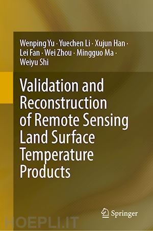
This book focuses on validation and reconstruction work on the land surface temperature (LST) products retrieved by thermal infrared remote sensing. The LST is a key parameter in the energy-water balance process and has been widely used in research on the global climate change, water cycle, vegetation growing, and drought detection. Remote sensing retrieving LST is the most important source for regional and even global application. However, there are several factors that limited their widespread use: (1) the thermal infrared remote sensing is easily influenced by clouds; therefore, there are lots of pixel with invalid LST; (2) LST products have not been sufficiently validated in global scale. This book arms to overcome above defects and guide the readers to estimate the LST of cloudy pixel and implement the general validation on the remote sensing LST. Furthermore, it helps to understand the scale mismatch between different observation and land surface heterogeneity. The book covers ground-based observation, validation and reconstruction theories, scale mismatch analysis, heterogeneity and representativeness evaluation for observations, and application cases. It is an essential reference to the quantitative retrieval of thermal infrared remote sensing technologies.
Overview.- Scale Mismatch Implications for the Validation of Remote Sensing LST Products.- Analysis on the Representation of the Station Observation Based on the Land Surface Spatial Heterogeneity.- Generalized T based Validation of Remote Sensing LST Products According to Land Surface Heterogeneity Analysis on Stations.- Validating Satellite derived LST over Heterogeneous Land Surfaces.- LST Reconstruction on the Remote sensed LST Products under clouds.- All weather land surface temperature estimation from the multiple source fusion.
Wenping Yu is Associate Professor at Southwest University in Chongqing, China. She obtained her B.S. and Ph.D. degrees in Cartography and Geographic Information Systems from the University of Chinese Academy of Sciences, Lanzhou, China, in 2012 and 2015, respectively. She served as Visiting Scholar at the Engineering Science, Computer Science, and Imaging Laboratory (ICube Laboratory) at the University of Strasbourg, France, from 2017 to 2018. Yu is Member of the Thermal Infrared Remote Sensing Professional Committee. Her research focuses on quantitative remote sensing in the thermal infrared field, particularly in land surface temperature retrieval, validation, and reconstruction, as well as monitoring thermal environmental changes.
Yuechen Li - Professor and PhD Supervisor at Southwest University, School of Geographical Science, Chongqing, China. Engages primarily in remote sensing and GIS applications, with a focus on resources, environment, and national land space monitoring and assessment. Email: liyuechen@swu.edu.cn
Xujun Han - Professor and PhD Supervisor at Southwest University, School of Geographical Science, Chongqing, China. His research includes multi-source remote sensing data assimilation, model integration, and high-performance computing for land surface analysis. Email: hanxujun@swu.edu.cn
Lei Fan - Professor and PhD Supervisor at Southwest University, School of Geographical Science, Chongqing, China. His research Focuses on:(1)Microwave remote sensing inversion for vegetation optical depth and soil moisture; (2)Forest carbon stocks monitoring via passive microwave sensing; (3)Forest carbon sinks and global change response mechanisms. Email: leifan33@swu.edu.cn
Wei Zhou - Associate Professor at Southwest University, School of Geographical Science, Chongqing, China. Specializes in ecological environment remote sensing including: (1) simulation of terrestrial vegetation carbon sources and sinks; (2)quantitative assessment of land degradation; (3)remote sensing inversion of soil nutrients and soil quality assessment. Email: zhouw866@163.com
Mingguo Ma - Professor and PhD Supervisor at Southwest University, School of Geographical Science, Chongqing, China. Focuses on global terrestrial ecology remote sensing and evluation on land surface remote sensing products. Email: mmg@swu.edu.cn
Weiyu Shi - Professor and PhD Supervisor at Southwest University, School of Geographical Science, Chongqing, China. Mainly engaged in research on climate change and terrestrial ecosystem processes. Email: shiweiyu@swu.edu.cn


Il sito utilizza cookie ed altri strumenti di tracciamento che raccolgono informazioni dal dispositivo dell’utente. Oltre ai cookie tecnici ed analitici aggregati, strettamente necessari per il funzionamento di questo sito web, previo consenso dell’utente possono essere installati cookie di profilazione e marketing e cookie dei social media. Cliccando su “Accetto tutti i cookie” saranno attivate tutte le categorie di cookie. Per accettare solo deterninate categorie di cookie, cliccare invece su “Impostazioni cookie”. Chiudendo il banner o continuando a navigare saranno installati solo cookie tecnici. Per maggiori dettagli, consultare la Cookie Policy.