libri scuola books Fumetti ebook dvd top ten sconti 0 Carrello


Torna Indietro

van sickle jan - gps and gnss for land surveyors, fifth edition

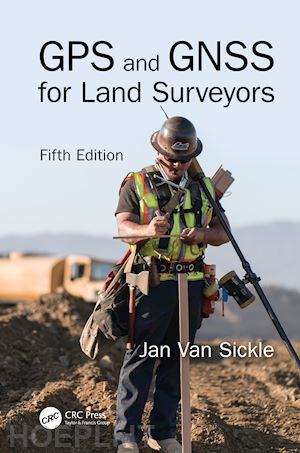
GPS and GNSS for Land Surveyors, Fifth Edition


Disponibilità: Non disponibile o esaurito presso l'editore


PREZZO
116,90 €


Questo prodotto usufruisce delle SPEDIZIONI GRATIS
selezionando l'opzione Corriere Veloce in fase di ordine.


Pagabile anche con Carta della cultura giovani e del merito, 18App Bonus Cultura e Carta del Docente


Facebook Twitter Aggiungi commento


Spese Gratis

Dettagli

Genere:Libro
Lingua: Inglese
Editore:

CRC Press

Pubblicazione: 07/2023
Edizione: Edizione nuova, 5° edizione


Note Editore

Based on the success of the previous four editions, this new edition includes in the title Global Navigation Satellite Systems (GNSS) of which GPS is part. The book provides an introduction to the concepts needed to understand and use GPS and GNSS. Neither simplistic nor overly technical, the new edition is thoroughly updated with the changes in GPS and GNSS hardware, software, and procedures. It describes why modern GNSS positions can be acquired with more certainty, with increased stability, and improved tracking in obstructed areas. The book offers a rare combination of knowledge and skills that every land surveyor needs to master. Features 1. Written by a well-known land surveyor with extensive knowledge in satellite navigation and ability to explain difficult concepts to a broad audience. 2. Includes a useful set of self-assessment exercises and explanations at the end of each chapter. 3. Takes a practical approach to the rapid and continuous technological progress in GNSS. 4. Provides the latest information on GNSS and GPS. 5. Minimizes the reliance on mathematical explanations and maximizes the use of illustrations and examples that allow the reader to visualize and grasp the concepts. Intended for both ingenues and professionals in the field, this book explains broad concepts in an accessible way. It provides undergraduate students in Civil Engineering, Geomatic Engineering, and those taking introductory GPS and GIS Mapping Courses, as well as professionals in the field, a practical approach to GPS and GNSS technology.


Sommario

1. The Signal 2. Biases and Solutions 3. The Framework 4. Receivers and Methods 5. Coordinates 6. Static GNSS Surveying 7. Real-Time GNSS Surveying 8. GPS Modernization and Global Navigation Satellite System (GNSS)


Autore

Jan Van Sickle has been a licensed Professional Land Surveyor for forty-three years and is currently licensed in Colorado, California, Oregon, Texas, North Dakota, West Virginia, and Pennsylvania. He supervised control work using the first commercial GPS receiver suitable for geodetic work, the Macrometer V-1000. He led the team that produced control positions for more than 120 cities around the world, assisted in the first GPS survey of the Grand Canyon, was involved in the BIM of the White House, gave technical assistance in the reconstruction of the geodetic network of Nigeria, managed the imagery and gravity analysis in the South Gobi, delivered the 2021 keynote at the NSPS URISA Summit, taught at Penn State and the University of Colorado, and was a member of the Royal Institute of Chartered Surveyors. Jan earned his Ph.D. in geospatial engineering from the University of Colorado. He is an ASPRS Certified Photogrammetrist and Mapping Scientist, Lidar and the Principal Geodetic Engineer at Maxar Technologies. Website: www.janvansickle.com


Altre Informazioni

ISBN:

9781032521022

Condizione: Nuovo
Dimensioni: 9.25 x 6.25 in
Formato: Copertina rigida
Illustration Notes:6 b/w images, 125 color images, 5 halftones, 123 color halftones, 1 line drawing and 2 color line drawings
Pagine Arabe: 432
Pagine Romane: xx


Dicono di noi