Questo prodotto usufruisce delle SPEDIZIONI GRATIS
selezionando l'opzione Corriere Veloce in fase di ordine.
Pagabile anche con Carta della cultura giovani e del merito, 18App Bonus Cultura e Carta del Docente
South Asia, harboring the complex Himalayan terrains, has over one-fifth of the world’s population and is recognized as the most hazard-prone region of the world. The exponential increase in population with the consequent pressure on natural resources and continued high rates of poverty and food insecurity also makes this region the most vulnerable region to hazards in the world as far as the impacts of climate change are concerned.
Over the last century, the climatic trends in South-Asia have been observed to be characterized by increasing air temperatures and an increasing trend in the intensity and frequency of extreme events. IPCC (2014) has reported that the Himalayan highlands shall face significant warming over the next century. The increasing frequency of natural hazards due to the impacts of climate change in the Himalayas calls for efficient management and policymaking in these regions, which can only be implemented by the local governments through an established science-based robust action plan.
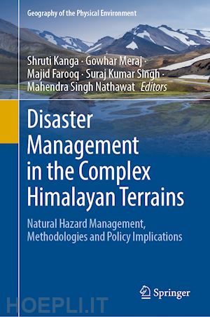
This edited volume focuses on the management of natural hazards using innovative techniques of spatial information sciences and satellite remote sensing. It contains chapters from eminent researchers and experts in the field of hazard management, remote sensing, and GIS. The primary focus of this book is to replenish the gap in the available literature on the subject by bringing the concepts, theories, and practical experiences of the specialists and professionals in this field together in one volume to help students, researchers, and policymakers to address issues concerning management and policy implications of natural hazards in the complex Himalayan region.
Part-A: Introduction to the Disasters and Hazards in the Himalayan Terrains.- 1. Disasters in the Complex Himalayan Terrains.- 2. Hazards in the perspective of Himalayan Terrain: A review.- Part-B: Landslides in the Himalayas – Causes and Consequences.- 3. Himalayan Landslides – Causes and Evolution.- 4. Landslides in the Himalayas: Causes, Evolution, and Mitigation – A Case Study of National Highway 44, India.- 5. Geo-environmental Impact of Road Widening Project along the National Highway- 44A, Jammu & Kashmir, India.- Part-C: Floods in the Himalayas – Causes and Consequences.- 6. September 2014 floods in Kashmir Himalaya - Impacts and Mitigation Strategy.- 7. A review on the estimation of Glacial Lake Outburst Floods (GLOFs) in the Himalayan region using remote sensing and geographic information system.- 8. Impact of Floods on the Green Energy Sector in the Himalayas using remote sensing and geographic information system (GIS) – A case study of Gagas Watershed, Uttarakhand, India.- Part-D: Earthquakes in the Himalayas – Assessment and Forecasting.- 9. Synthetic Aperture Radar Interferometry to Measure Earthquake Related Deformation: A Case Study from Nepal.- 10. Earthquake Forecasting in the Himalayas using Artificial Neural Networks.- Part-E: Hazard mitigation strategies in the Himalayas.- 11. Forest Fire Alert System of India with a Special Reference to Fire Vulnerability Assessment of the UT of Jammu and Kashmir.- 12. Hazard mitigation and climate change in the Himalayas – Policy and Decision making.


Il sito utilizza cookie ed altri strumenti di tracciamento che raccolgono informazioni dal dispositivo dell’utente. Oltre ai cookie tecnici ed analitici aggregati, strettamente necessari per il funzionamento di questo sito web, previo consenso dell’utente possono essere installati cookie di profilazione e marketing e cookie dei social media. Cliccando su “Accetto tutti i cookie” saranno attivate tutte le categorie di cookie. Per accettare solo deterninate categorie di cookie, cliccare invece su “Impostazioni cookie”. Chiudendo il banner o continuando a navigare saranno installati solo cookie tecnici. Per maggiori dettagli, consultare la Cookie Policy.