
Questo prodotto usufruisce delle SPEDIZIONI GRATIS
selezionando l'opzione Corriere Veloce in fase di ordine.
Pagabile anche con Carta della cultura giovani e del merito, 18App Bonus Cultura e Carta del Docente
Participatory GIS (PGIS) is important in social science research because it provides a powerful tool for exploring and comprehending various socio-spatial phenomena. It makes it easier to investigate intricate spatial relationships, community dynamics, and the effects of policies and interventions on local populations. Researchers can also use it to map and analyze the spatial distribution of social concerns, resources, and assets within a community.
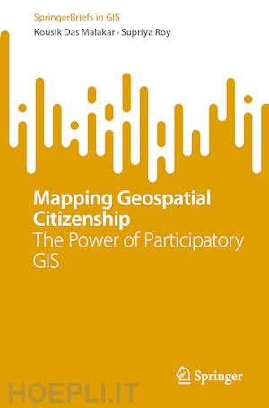
This Brief delves into the transformative potential of Participatory GIS (PGIS) in empowering communities and amplifying their voices through geospatial technologies. This book provides an in-depth discussion of PGIS, including approaches, data collection techniques, participatory mapping, critical discussions, the concept and thinking of geospatial citizenship, applications of participatory GIS in terms of socio-ecological concern, geographies and socio-spatial ecologies of a societal space, community cartography, challenges, and future directions. The book also offers real-world case studies that leverage PGIS technology to map the voices of ordinary people. Case studies include mapping natural resource management, modelling mangrove forest ecologies, indigenous technical knowledge of fish catching, social vulnerability to climate change in the coastal community, and identification of traditional coastal fishing sites.
The book emphasizes the necessity of community involvement in decision-making processes, as well as the awareness of their perspectives in formulating policies and programs, through the lens of PGIS. It highlights how geospatial technologies can be a strong tool for community empowerment, allowing individuals to actively shape their surroundings and build a sense of ownership over their shared spaces.
Chapter 1: Introduction to Geospatial Citizenship.- Chapter 2: Understanding of Participatory GIS: Concepts and Techniques.- Chapter 3: Applications of Participatory GIS: A Socio-ecological Approaches and Mapping.- Chapter 4: Geographies and Socio-spatial Ecologies of a Societal Space: A Journey into Participatory GIS.- Chapter 5: Community Cartography and Participatory GIS.- Chapter 6: GIS for All: Challenges and Future Directions.- Chapter 7: Importance and Scope of Voices Mapping in Coastal Communities: The Case of Coastal World.- Chapter 8: Voices Mapping of Coastal Communities: Field Narratives from the Coastal Medinipur and Sundarbans.- Chapter 9: Mapping Community Voices in the Coastal Region of Bengal: Case Studies and Best Practices of Participatory GIS.- Chapter 10: The Power of Participatory GIS: Disciplinary Principles and Research Scope.
Kousik Das Malakar is a socio-ecological geographer and GIS analyst. Currently work as a senior research fellow (doctoral) in the Department of Geography, School of Basic Sciences, Central University of Haryana, India. He holds a master's degree in social science geography from Jawaharlal Nehru University (JNU) in New Delhi, as well as a bachelor's degree in social science geography from Vidyasagar University in Medinipur. In his research area, Mr. Malakar has attended over 150 conferences/workshops/seminars/webinars and has published books and research articles in national and international journals. He has received numerous certifications from the Indian Institute of Remote Sensing (IIRS) in Dehradun, the Geological Survey of India (GSI) in Hyderabad, and the National Institute of Disaster Management (NIDM) in New Delhi for his ability to participate in and acquirement of research ideas and knowledge. He is an active journal reviewer and a member of the Human Development and Capability Association (US), the Unequal World (US), and the International Society for Urban Health (US). Climate crisis, socio-ecological systems (governance and security), socio-ecological transformation, coastal society, environments, sustainability, sustainable thinking, disaster studies, and geospatial technologies are among his research interests.
Supriya Roy is a GIS analyst and socio-environmental geographer. She holds a master's degree in social science geography from the Department of Geography, Institute of Humanities & Social Sciences, Visva-Bharati University, Santiniketan, as well as a double bachelor's degree in social science geography from the University of Gour Banga and Vidyasagar College of Education, West Bengal (India). In her field of research, she has participated in more than 100 workshops/ seminars/ conferences/webinars, along with contributing research articles to both national and international journals. She has been awarded multiple certifications from NIDM (New Delhi) and IIRS (Dehradun) for her active participation in research and the acquisition of knowledge and research ideas. Her research interests encompass a diverse range of topics, including coastal indigenous communities, anthropo-environmental conflicts, climate justice, climate migration, society and politics, participatory policy planning, and the applications of geographic information science.


Il sito utilizza cookie ed altri strumenti di tracciamento che raccolgono informazioni dal dispositivo dell’utente. Oltre ai cookie tecnici ed analitici aggregati, strettamente necessari per il funzionamento di questo sito web, previo consenso dell’utente possono essere installati cookie di profilazione e marketing e cookie dei social media. Cliccando su “Accetto tutti i cookie” saranno attivate tutte le categorie di cookie. Per accettare solo deterninate categorie di cookie, cliccare invece su “Impostazioni cookie”. Chiudendo il banner o continuando a navigare saranno installati solo cookie tecnici. Per maggiori dettagli, consultare la Cookie Policy.