libri scuola books Fumetti ebook dvd top ten sconti 0 Carrello


Torna Indietro

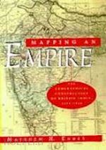
edney matthew - mapping an empire – the geographical construction of british india, 1765–1843

Mapping an Empire – The Geographical Construction of British India, 1765–1843 The Geographical Construction of British India, 1765-1843


Disponibilità: Normalmente disponibile in 20 giorni
A causa di problematiche nell'approvvigionamento legate alla Brexit sono possibili ritardi nelle consegne.


PREZZO
37,00 €
NICEPRICE
35,15 €
SCONTO
5%


Questo prodotto usufruisce delle SPEDIZIONI GRATIS
selezionando l'opzione Corriere Veloce in fase di ordine.


Pagabile anche con Carta della cultura giovani e del merito, 18App Bonus Cultura e Carta del Docente


Facebook Twitter Aggiungi commento


Spese Gratis

Dettagli

Genere:Libro
Lingua: Inglese
Pubblicazione: 05/1999


Trama

List of Illustrations and Maps List of Tables Preface Note on East India Company Coinage Places Mentioned in the Text: Southern India and Northern India Chronology of Events and the Expansion of the East India Company Ch. 1: The Ideologies and Practices of Mapping and Imperialism Ch. 2: Observation and Representation Ch. 3: Surveying and Mapmaking Ch. 4: Structural Constraints of the East India Company's AdministrationCh. 5: Cartographic Anarchy and System in Madras, 1790-1810 Ch. 6: Institutions for Mapping All of British India, 1814-23 Ch. 7: Triangulation, the Cartographic Panacea, 1825-32 Ch. 8: The Final Compromise: Triangulation and Archive, 1831-43 Ch. 9: Scientific Practice: Incorporating the Rationality of Empire Ch. 10: Cartographic Practice: Inscribing an Imperial Space Biographical Notes Notes Unpublished Primary Sources, by Archive Published Primary Sources Secondary Sources Relating to the British Surveys in India Principal Secondary Sources Index


Altre Informazioni

ISBN:

9780226184883

Condizione: Nuovo
Dimensioni: 229 x 26 x 152 mm Ø 675 gr
Formato: Brossura
Pagine Arabe: 480


Dicono di noi